Starting point
Berdorf: Tourist Info
Destination
Berdorf: Martbusch Leisure Center
Distance
4,35 km
Duration
1:20 h
Difficulty
medium
  • Condition
Highest point
368 Hm
Lowest point
316 Hm
Aggregated Ascent
52 Hm
Aggregated Descent
52 Hm
Circular routes

Description

The local path B2 is a hike with an adventure guarantee for the whole family.

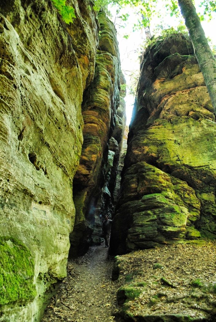
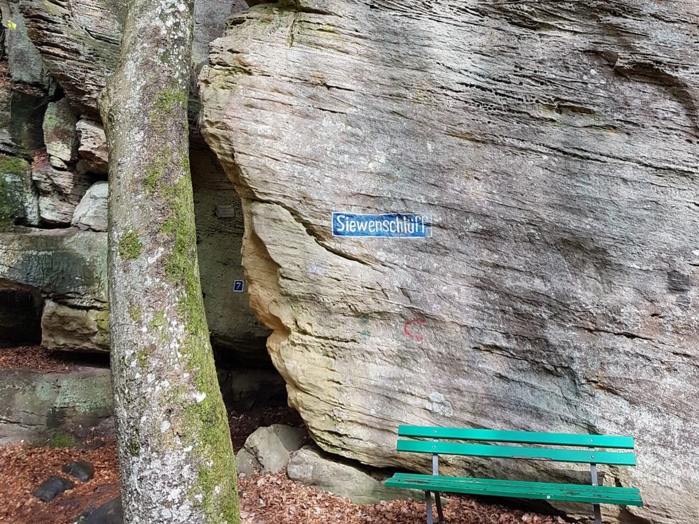
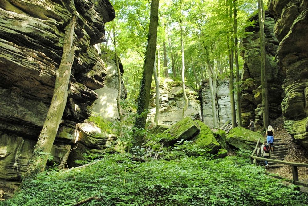
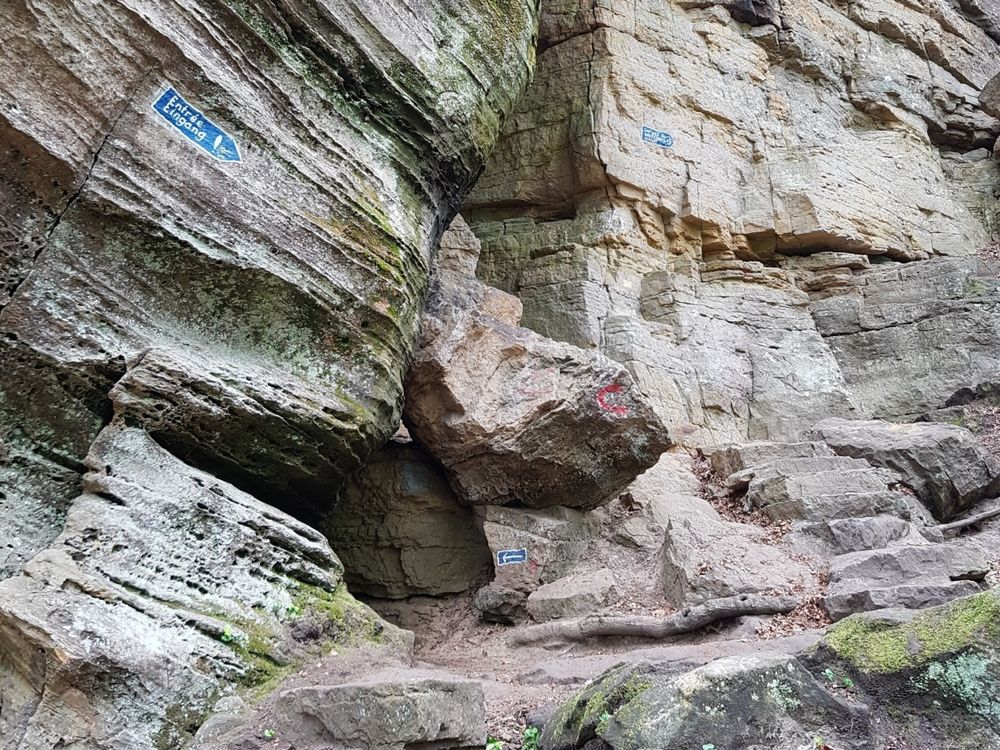
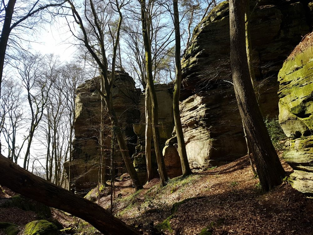
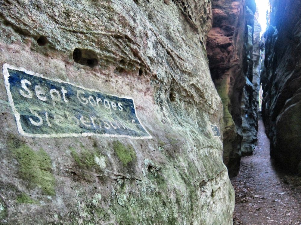
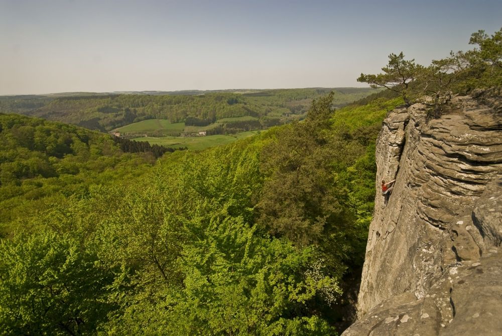
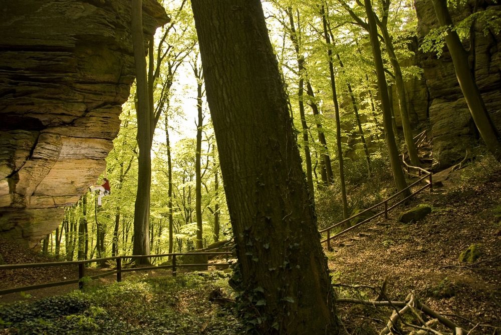
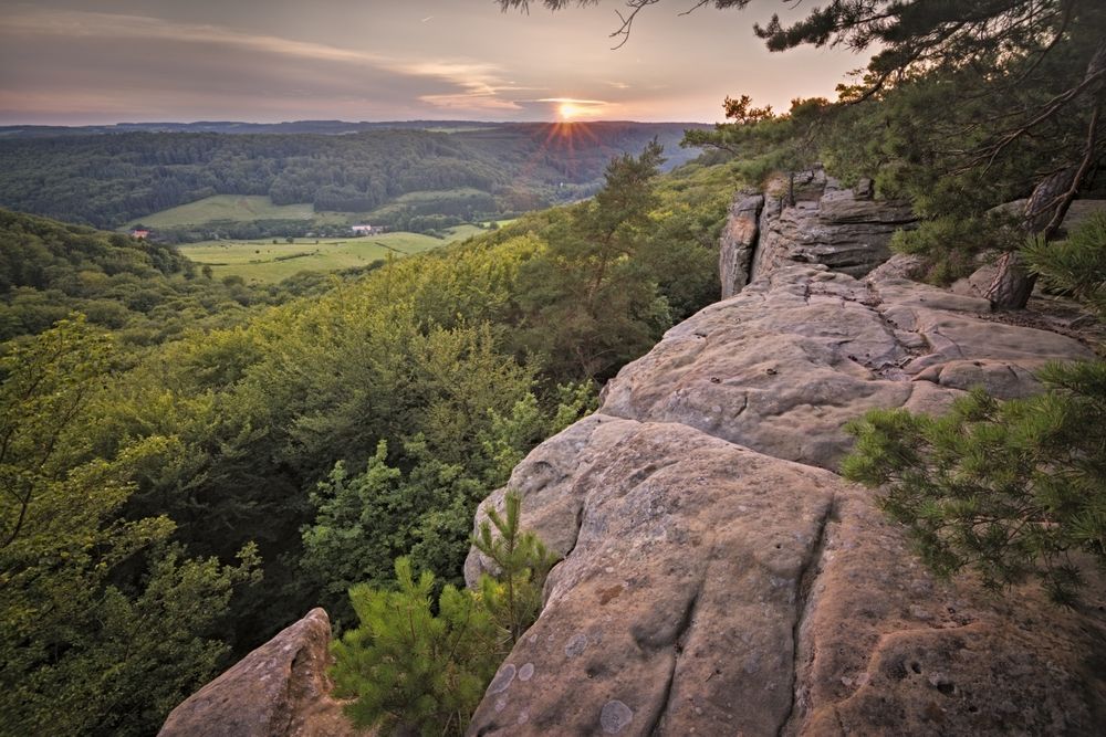
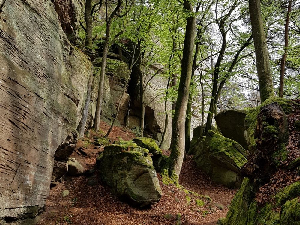
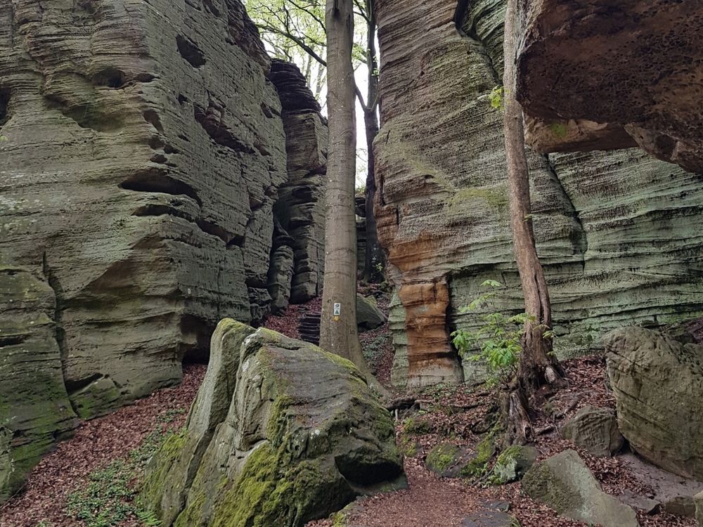
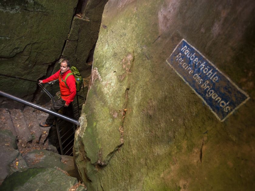
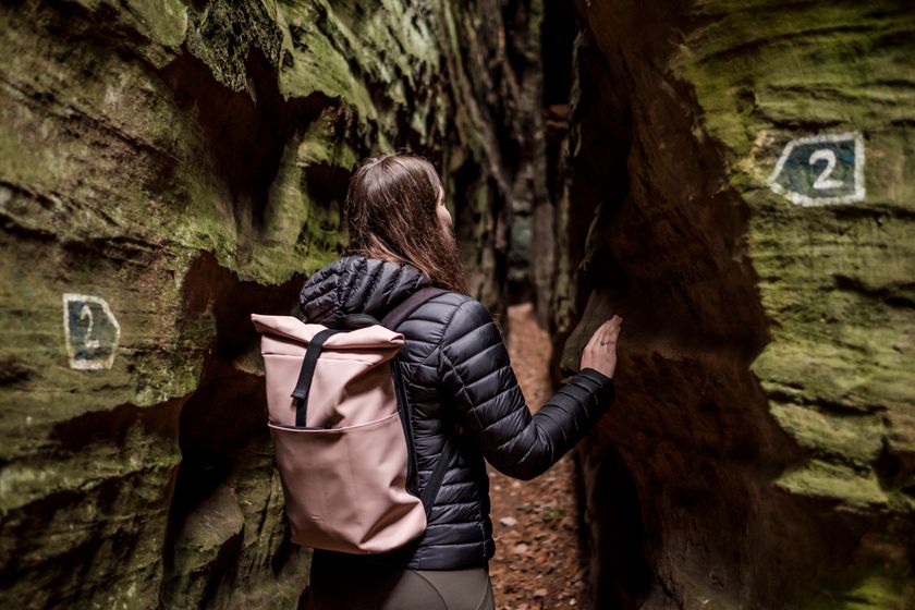
After just a few meters you will reach the romantic canyon of Ruetsbech. Sporty hikers and those looking for an adventurous kick should absolutely roam the mysterious Ruetsbechschlëff, explore the Raiberhiel cave and climb up the iron ladder to Adlerhorst! An ascent to the beautiful viewpoints Ruetsbechplateau and Däiwelsinsel is absolutely recommended. All these unique sights are set on a barely two-hectare large area. And yet you can indulge in a long exploration tour in a fairytale setting. The itinerary crosses an old Roman road, follows the narrow path along the rocky outcropping and, after about 600 m, flows into the Wanterbaach climbing area with the famous Siweschlëff at the end. The passage through the „Schlüff“ and the ascent to the viewpoint is an absolute must!

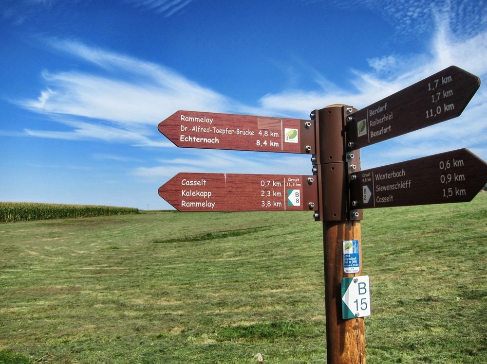
From Kaasselt, B2 runs along an almost flat forest path back to the leisure center Martbusch.


Suggestions nearby

Local hiking trail - B2

  • © Pancake! Photographie
    Geolandscape "Wanterbaach-Siweschlëff"
    Explore the impressive rock labyrinth amid steep rocky gorges.
    Find out more
  • © Pancake! Photographie
    Tourist Info Berdorf
    Tourist Info Berdorf
    Find out more
  • Rock formation "Raiberhiel"
    Enter one of the narrowest caves in the region and climb out again via the stairs.
    Find out more

Similar hiking tours

© Pulsa Pictures, Pulsa Pictures - ORT SUD
Minett Trail
Minett Trail: Rumelange Gare - Esch-sur-Alzette (Alternative)
Distance: 16,06 km
Duration: 4:35 h
Difficulty: medium
Find out more
© Visit Luxembourg
Distance trails
CFL-Bahnwanderweg 4 (Drauffelt - Kautenbach)
Distance: 16,13 km
Duration: 4:50 h
Difficulty: medium
Find out more
© Eric Hahn, Visit Luxembourg
Distance trails
CFL-Bahnwanderweg 8 (Wiltz - Merkholtz - Kautenbach)
Distance: 13,37 km
Duration: 4:20 h
Difficulty: medium
Find out more
© Visit Luxembourg
Distance trails
CFL-Bahnwanderweg 13 (Colmar-Berg - Mersch)
Distance: 10,42 km
Duration: 2:45 h
Difficulty: medium
Find out more
© Eric Hahn, Visit Luxembourg
Circular routes
Auto-Pédestre trail Bettendorf
Distance: 11,74 km
Duration: 3:15 h
Difficulty: medium
Find out more
© Eric Hahn, Visit Luxembourg
Circular routes
Auto-Pédestre trail Boulaide
Distance: 9,26 km
Duration: 2:50 h
Difficulty: medium
Find out more
© Jeniska Photography, Visit Guttland
Guttland.Trails
Guttland.Trail Fuussepad
Distance: 11,15 km
Duration: 3:10 h
Difficulty: medium
Find out more
© Jeniska Photography, Visit Guttland
Guttland.Trails
Guttland.Trail Mamerleeën
Distance: 7,53 km
Duration: 2:25 h
Difficulty: medium
Find out more
© Guy Krier, Visit Guttland
Circular routes
Auto-pédestre trail Redange
Distance: 8,10 km
Duration: 2:12 h
Difficulty: medium
Find out more
© European Easy-to-Read Logo: Inclusion Europe. More information at   www.easy-to-read.eu